Seeing Out the Other Eye | A View Through Waller Creek
“...a twist of water asking a question”
Carl Sandberg, Moon River
Waller Creek runs along the eastern edge of the heart of downtown Austin, Texas. This humble yet unruly waterway bears the name of the city’s first urban planner and is inscribed with its legacies of division and displacement. Since Austin’s initial urban grid overlaid the creek’s natural flood plain, the two have had a troubled relationship. Austin’s marginalized residents have repeatedly born the brunt. Through altered archival photos of Waller Creek floods, constructed monotypes, and installation with video projection, I invite contemplation and excavation of the intertwining histories of urban development and displacement.
As a living, developing project, this work was first exhibited in a solo exhibition at Flatbed Center for Contemporary Printmaking in 2022. Several works are editioned in collaboration with Flatbed Press and available through their gallery. In 2023 it was featured in Narrated Memories at TAG Gallery, with artists Laurie Frick and Michael Villareal, in honor of ACC’s 50th anniversary celebrations.

Scar (Not Too Close) polymer photogravure, chin colé, paper: 21"x30", image: 8.5"x22.5", 2022

Other Eye | Daydream Like Mad, polymer photogravure, chin colé paper: 27"x20", image: 11.25"x15.5"

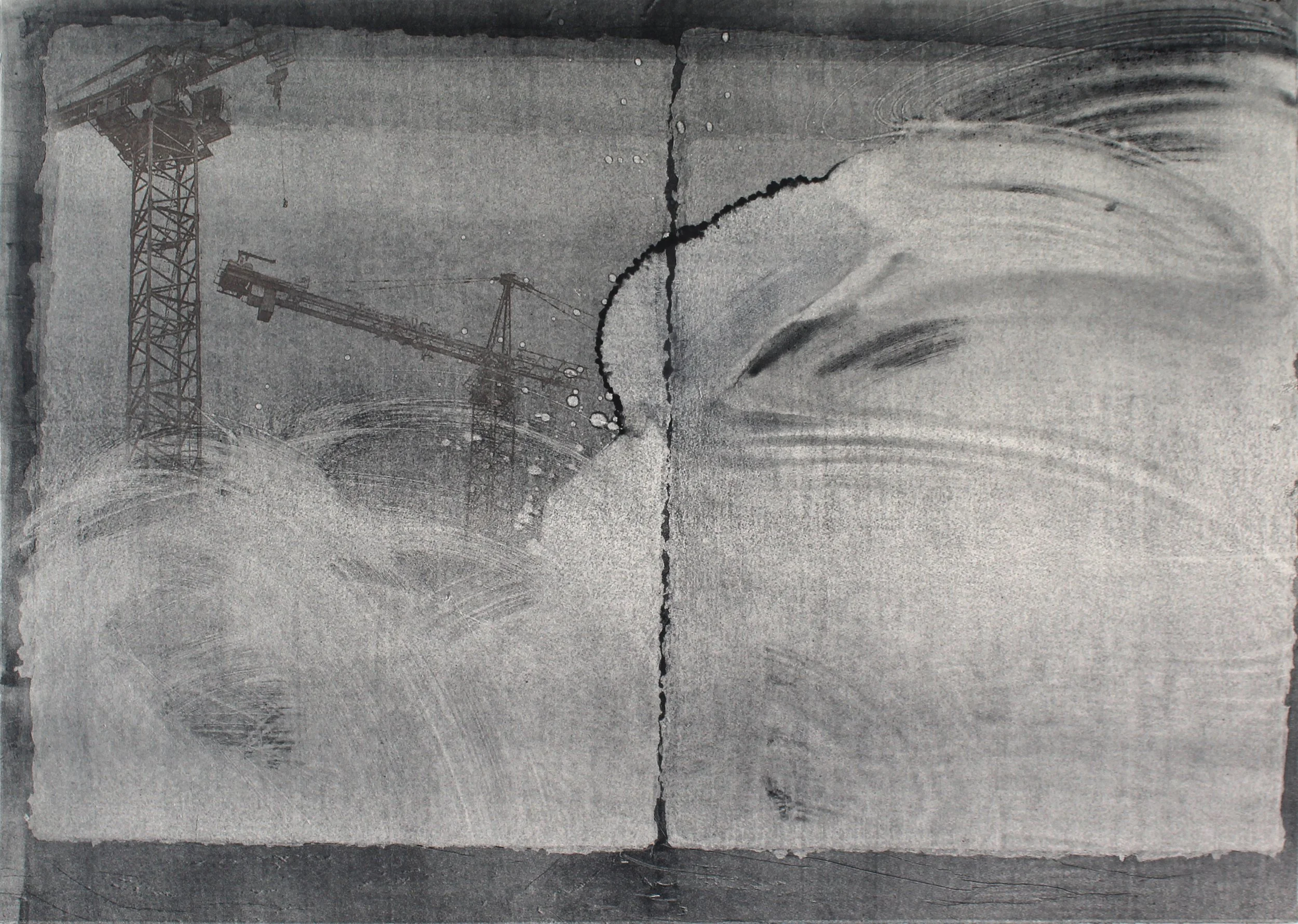
Memory Worker (that which we remember as opposed to that of which we are reminded), polymer photogravure, chin colé, paper: 27"x24", image: 16"x20"

Other Eye | Injustice Underway, polymer photogravure, chin colé paper: 27"x20", image: 19"x15"

Other Eye | Bottomlands & Parkways, polymer photogravure, chin colé, paper: 27"x20", image: 19"x15.5"
Progress, monoprint, toner transfer 29"x40.5"

Access: City Beautiful Project, monoprint, chin colé, 25.5"x20"

Access: Cyborg Creek, monoprint, chin colé, 25.5"x20"

Access: Flow, monoprint, chin colé, 25.5"x20"

Urban Renewal (Agency), monotype, frottage 24"x33.5"

Urban Renewal (Agency), detail of 'renewal' frottage

Hydro/Hydra, monotype, frottage 30"x20"

Hydro/Hydra (detail) Text: Hydro - Water / Hydra - A multifarious evil not to be overcome by a single effort

1880 (it used to be different), monotype, metal rivets and brads, 25.5"x20", from 1880 census data of households of African decent

1935 (it didn't have to be this way), monotype, chin colé, 25.5"x20", from the 1928 Austin Plan redlining map

Double Down (installation view, TAG Gallery, ACC Austin), handmade 'broken' mending tissue, cyanotype with flood erosion retention netting, fabric scrim, video projection, 10ft x 15ft, 2023

Double Down (installation view) TAG Gallery, ACC Austin

Double Down (detail)

Double Down (interior detail)

Double Down (scrim detail)

A brief history…
After the Civil War, newly freed people of color settling in Austin were relegated to reside in vulnerable terrain, flood-prone bottomlands and creek banks - primarily around Waller Creek. In 1928, as Jim Crow racism blossomed into institutionalized policies, Austin underwent a second round of urban development, following the guidance of the Koch & Fowler 1928 Austin Master Plan. A variety of urban development mechanisms (zoning, parks creation, manipulation of municipal utilities, etc.) were deployed to displace and concentrate people of non-european descent into East Austin, a dividing line inscribed by the construction of Interstate 35. Nevertheless, as historian Katherine Pace describes, a mixed-race edge zone persisted along Waller Creek and the adjacent Red River Street cultural-residential district which runs along the eastern edge of downtown Austin, just west of the highway. In the 1970’s and 80’s another wave of ‘city beautification’ swept this community away under the creation of Waterloo Park, hardening I-35 as the racial line of division. Meanwhile, despite significant financial investment, and primarily due to ongoing flood risk, the downtown stretch of Waller Creek became neglected by most, making it a welcoming corridor for unhoused people and wildlife. Yet another round of Waller Creek ‘beautification’ sprung up in the developer’s paradise of the early 2000’s (and ongoing) resulting in acres of parks, trails, an amphitheater, and an epic underground tunnel to divert floodwaters, ‘revitalize’ the creek, and attract investment. Simultaneously, Austin’s Black and brown residents have undergone a second great displacement under the pressures of East Austin gentrification.
Learn more about this history
‘Forgetting Waller Creek: Race, Parks and Planning in Downtown Austin, Texas’ by Katherine Leah Pace [link] [pdf]
‘An Environmental History of Waterloo Park’ by Katherine Leah Pace [link]
‘Shifting Terrains of Risk: A history of natural hazards and displacement in three historic black communities of Central Austin, Texas’ by Katherine Leah Pace [link]
‘Artificially Natural: On the Transformation of Austin's Waller Creek’ by Jack Murphy [link]
‘Austin Restricted: Progressivism, Zoning, Private Racial Covenants, and the Making of a Segregated City’ by Eliot M. Tretter [link]